Tag: New York History

  • A Fort Grows in Brooklyn–April 10, 1776

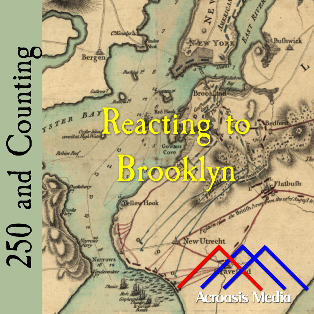
    Cover art for April 10, 1776: a contemporary map of Brooklyn. Red Hook is in the center of the picture, just below the "rt" in "Fort".

    The construction of Fort Defiance in the Red Hook section of Brooklyn made perfect sense. That part of the peninsula sticks out into New York Harbor and provides an excellent view of anything that might be sailing in or out.

    Red Hook comes from the Dutch Roode Hoek, “hoek” translating to “point”, which can still be seen in modern-day maps. The whole area, what we now call Red Hook and Gowanus, was settled by the Dutch in the 1630s.

    Red Hook was some swampy land when the Dutch moved in. But the Dutch know something about swampy land, and they got straight to work, filling in lakes and re-channeling waterways. They began farming the land, including orchards of fruit trees.

    After the war broke out and the Continental Army drove the British from Boston, George Washington sent Brigadier General William Alexander to Brooklyn to see what could be done defensively. A plan was developed to build two forts along the Brooklyn Heights, about a mile and a half apart. Fort Greene would be the furthest east, Fort Defiance would be the furthest west. Across the channel on Governor’s Island, another fort would be built, so that British ships could be fired on from both sides.

    Now, when we say “fort,” we’re not talking about something made of wood or stone. Plenty of those did exist, but not here. This was more like a breastworks built of earth and stone, which had a few cannons near the top. There were three of these breastworks connected by trenches, and they took up most of the island on which they stood. (Incidentally, Mike was correct about the island not existing anymore; the space was filled in and is now part of the larger land.) This took only a few days to put together; the fort at Governor’s Island was more like what one would expect to see.

    By the time the British arrived, the Continental Army was quite ready from a defensive standpoint. But the British were much larger in number and had a Navy besides. Stay tuned; it’s going to be an exciting summer.

  • William Tryon Isn’t Popular–March 22, 1776

    Cover art for March 22, 1776: "Governor Tryon and the Regulators." Alexander Bobbett's 1877 line engraving based on an earlier illustration by the prominent American artist Felix Octavius Carr Darley (F.O.C. Darley) in 1876.

    To be perfectly clear, William Tryon was never popular on this side of the pond.

    When he was appointed Lieutenant Governor in North Carolina in 1764, he wasn’t able to move into the usual housing for a man of that title because the previous inhabitant refused to move out.

    When the Stamp Act was enacted in 1765, there was a great deal of opposition in North Carolina, so he refused to allow meetings of the Assembly in order to prevent them from voting for a resolution formally opposing it.

    When he was appointed Royal Governor, he made plans for an elaborate new Governor’s Mansion that cost twice the amount of money allotted for it. Then he hired laborers from Philadelphia to construct it, saying that North Carolinians didn’t have the necessary skills.

    The 1771 Regulator Uprising that Mike talks about in today’s episode was the last straw for William Tryon in North Carolina, and many historians view it as the first sign that a true revolution was coming. Within a month of that event, he left North Carolina and headed for New York, where things, as you’ll hear, didn’t go any better.

  • Helping New York Help Itself–February 21, 1776

    Cover art for February 21, 1776: "Bowling Green, Broadway," by artist James Dakin and engraved by the firm Barnard and Dick, 1831. The house on the left became Washington's headquarters when he came to New York.

    There’s a line in the play 1776 about how everyone in the New York Legislature is very loud and talks very fast and as a result nothing ever gets done. This was likely a side effect of the fact that New York was so politically mixed at the time. Everyone hollering at rather than talking to each other means that nobody is truly connecting with anyone else. Thank goodness we’ve moved past THAT! <eyeroll>

    But New York and the Hudson Valley in particular held great strategic value for the various parties involved in the conflict we call the American Revolution. Britain taking that area would separate New England from the other Colonies. What’s more, George Washington knew it. So he devoted a lot of energy into ensuring that that territory remained defended, even while the British were nowhere in sight, because he knew it was a matter of time.

    And he was right: the British did show up ready for battle. It didn’t happen when he expected it to happen, and we’ll talk about that when things start heating up.

  • When Generals Meet–February 4, 1776

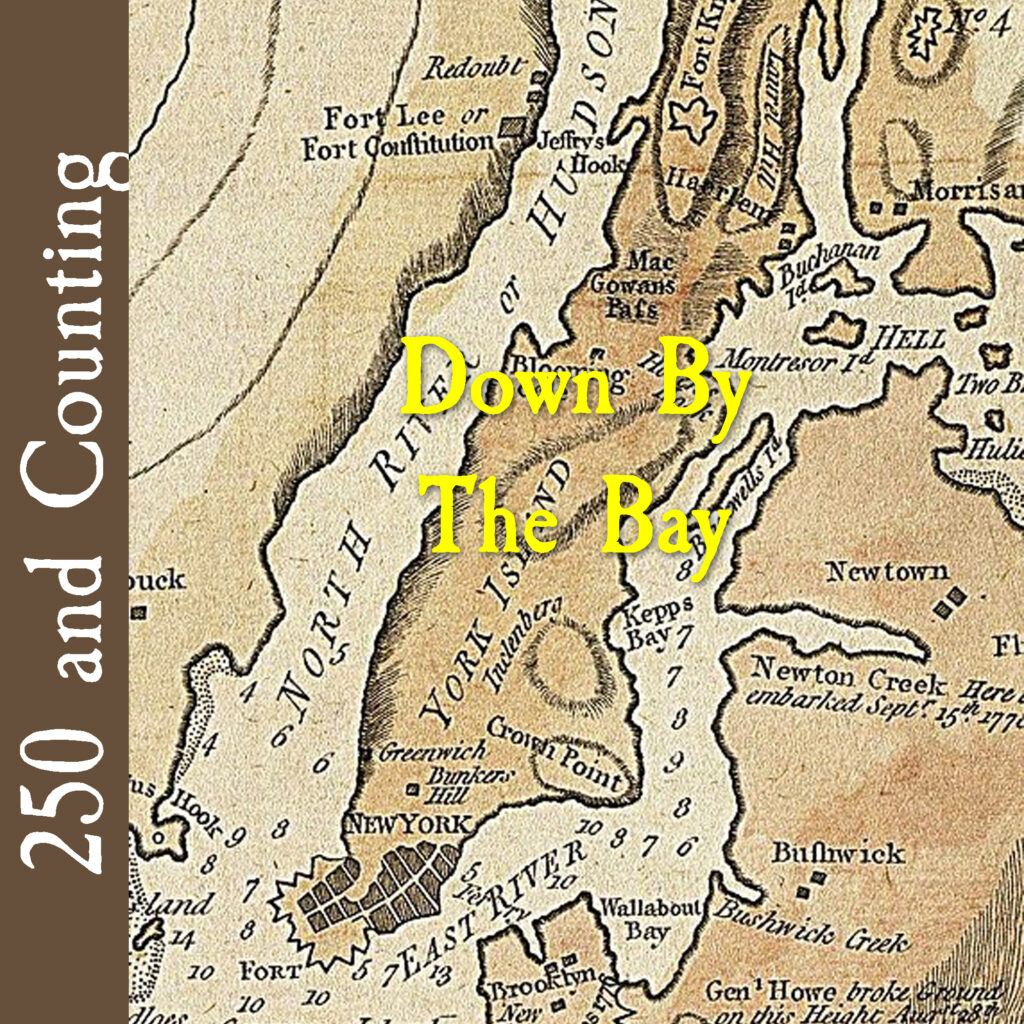
    Cover art for February 4, 1776: a war map of New York City from 1776. This was almost the entire city at that time.
    A war map of New York City from 1776. This was almost the entire city at that time.

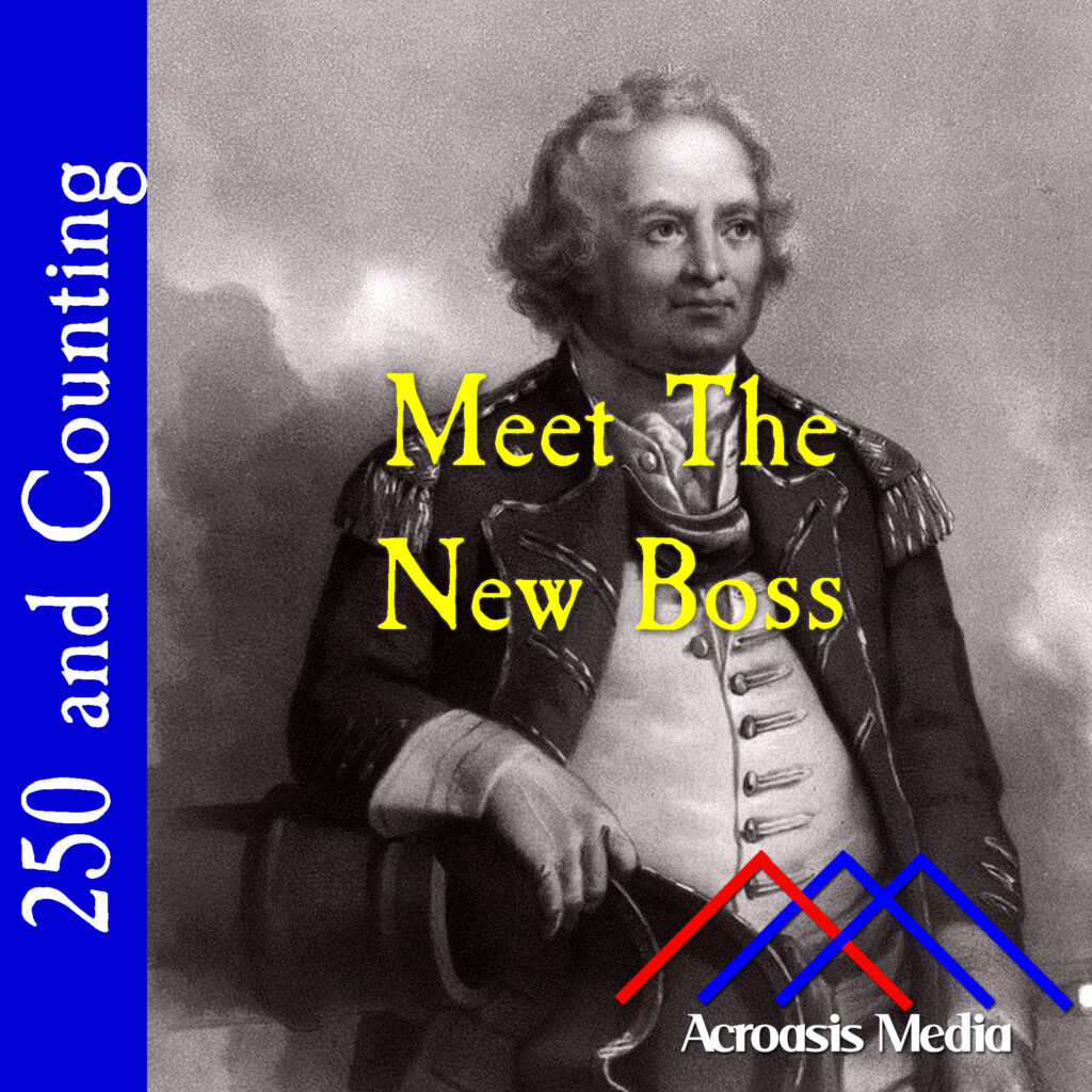
    OK, I’ll admit I cheated the title a little bit. The fact is, both General Charles Lee, who was part of George Washington’s inner circle, and General Henry Clinton, who was a British general, did arrive in New York City on the same day.

    The odds are pretty low that, despite how small New York City is compared to today, they actually encountered one another on this day.

  • The Fate of a Crew–January 31, 1776

    Cover art for January 31, 1776: Etching of William Alexander, Lord Stirling, as a Major General. Etching by H.B. Hall, 1892. via New York Public Library.
    Etching of William Alexander, Lord Stirling, as a Major General. Etching by H.B. Hall, 1892. via New York Public Library.

    The capture and ultimate disposition of the HMS Blue Mountain Valley and her crew was, in the bigger scheme of things, a relatively minor event in the American Revolution, however it did suddenly bring both New Jersey and New York into more active participation in the war.

    And even though the Blue Mountain Valley was beset by storms that they couldn’t possibly control, the fact that the ship was so easily captured despite the protections they’d put in place so far became a major point of debate back in England. It led to a policy prohibiting the use of transport ships to America unless they had a Naval escort.

    A policy like that is pretty good for keeping the ship and cargo losses down, but it wreaks havoc on the Naval resources. So this event was a win in the short run for the Americans, but it was a long-run win as well because of the way it inconvenienced the British over the next several years.

  • Our First Memorial–January 25, 1776

    Cover art for January 25, 1776: the monument erected to honor Richard Montgomery outside St. Paul's Chapel at Trinity Church. via Wikimedia Commons.
    The monument erected to honor Richard Montgomery outside St. Paul’s Chapel at Trinity Church.
    The inscription reads: This Monument is erected by the order of Congress, 25th, Janry, 1776, to transmit to Posterity a grateful remembrance of the patriotism conduct enterprise & perseverance of Major General Richard Montgomery
    Who after a series of successes amidst the most discouraging Difficulties Fell in the attack on Quebec. 31st, Decbr, 1775. Aged 37 Years.

    We weren’t even a nation yet and Congress had already commissioned the Richard Montgomery Memorial. And while the memorial itself was completed rather quickly by the commissioned artist, the war interfered with its transport and it took nearly ten years to find all the pieces.

    (Dirty Secret: they never found all of them; the urn at top center was a reproduction.)

    Montgomery was generally known to be a good general even if his death was practically inevitable, given the circumstances. But that didn’t stop people from turning him into a martyr for the cause of Independence.

    PS. Trinity Church’s website has a page dedicated to the monument, which aided my research for this episode. There’s a huge, fascinating segment dedicated to the 2011 restoration process for this memorial.

  • Preparing To Defend New York–January 7, 1775

    Cover art for January 7, 1775: Portrait of Jonathan Trumbull and his wife Faith, painted by his son John Trumbull, 1778. via New York Public Library.
    Portrait of Jonathan Trumbull and his wife Faith, painted by his son John Trumbull, 1778. via New York Public Library.

    There are many letters between George Washington and Connecticut Governor Jonathan Trumbull. Presumably something as simple as proximity to another leader was attractive to both of them, especially in an age where letters took several days to go a hundred miles.

    We have to presume that the two men had very reliable people transporting these letters, given how much detail is in this one regarding Washington’s guesses about British troop movements and exactly what he was going to do about it. It’s certainly been the case before that correspondence has been intercepted by the British in the past, and the Postal Service hadn’t been up and running for very long by that point.

    At any rate, Washington was correct in that the British were taking a hard look at New York City (still mostly just the southern tip of Manhattan, mind you) and the palisades along the Hudson River, which was still called the North River then. Where he was likely incorrect was in the timing of that move, which may have resulted in a little complacency.

  • Jeromus Johnson–November 2, 1775

    Cover art for November 2, 1775: Jeromus Johnson, 1832. Oil on canvas portrait by William Sidney Mount. via the Brooklyn Museum.

    It’s noted that Brooklyn is the place where Jeromus Johnson was born, but to be more specific, Johnson was born in a neighborhood called Wallabout, which still exists but Johnson wouldn’t recognize it today. Wallabout got its name from the adjacent Wallabout Bay, which has been mostly filled in and is now occupied by the Brooklyn Navy Yard. “Wallabout” is a corruption of a French phrase meaning “bend in the harbor”.

    For all that, you rarely hear the name Wallabout anymore; the village has been largely absorbed by Fort Greene, Bedford-Stuyvesant and Clinton Hill.

    How do I know all this? I used to work a few blocks from there.

    Another personal connection: the town to which Johnson retired is Goshen, NY, in Orange County. My oldest daughter used to go to school up that way, and to avoid traffic I’d often visit her by driving a state highway that passed right through Goshen. It’s a lovely, rustic-looking village (at least it was ten years ago), and that area is a nice, relaxing drive.

    But what about Jeromus Johnson? Go listen to Mike.

  • September 28, 1775: A Friendly Meeting With The Natives

    Cover art for September 28, 1775: Oil on canvas portait of Rev. Samuel Kirkland painted by Augustus Rockwell in the 1870s.

    First off: let me apologize for not tutoring Mike in the correct pronunciation of “Iroquois.” I’d make him record that part again but he’s at a podcasting conference and away from his studio. (It only looks like a French word, Mike; it’s not pronounced like one.)

    Of course, I grew up in New York so those tribes were kind of beaten into us during Social Studies classes.

    At any rate, we’ve talked in the past about efforts to get the various tribes in upstate New York to join the war effort, but the problem that the Patriots bumped into was that their “family argument” metaphor was taken too well, and the Native American tribes decided that this was exactly the case, and opted to stay out.

    All of them, but one in particular. Tune in and find out which.

  • September 23, 1775: Independence Day on Long Island

    Cover art for September 23, 1775: a 1777 map of the western end of Long Island by John Montresor. via the Norman B. Leventhal Map & Education Center, Boston Public Library.

    For those of you new to this podcast (or those who haven’t been paying attention), I grew up on Long Island, and have lived or worked pretty much from one end of the map in today’s cover art to the other at one time or another.

    For instance, my childhood home is just about where the Long Island portion of the map ends at the top right.

    I did my undergrad work approximately where the “H” appears just above Hempstead. I got my graduate degree at a school along that road between Oyster Bay and Huntington.

    So when a story like this pops up, it’s a lot of fun for me to research and record, because I learn so much.

    One of the names I expected to see in my research didn’t turn up, however. That would be the Denton family, which was located in modern-day New Hyde Park. They were also quite influential in the development of the Hempstead area, but that was in the 1600s. By the 1770s they were a revered name but not especially influential.

    The Denton home, a mansion for its time, still stands today. It was empty for several years when I was a young adult, then it became a restaurant for a bit. The McDonald’s Corporation purchased the property, intending to knock it down and build a new restaurant there, but a local historical society intervened and got the building historic status. After a couple of years of negotiation, McDonald’s renovated the building so that it retains its colonial-era charm. If you’re ever in the area, check it out. It’s one of the coolest McDonald’s restaurants you’ll ever see, inside and out.

    According to the person who posted this photo to Wikipedia, he caught grief from store management for trying to take a photo from the parking lot, so this is a "drive-by" shot from his moving car on the street.